What is GIS?
GIS stands for Geographic Information System. It is a system designed to capture, store, manipulate, analyze, manage, and present spatial or geographic data. In other words, GIS is used to create maps and analyze spatial data for a wide range of applications.
In this note, we'll cover some basic GIS concepts and tools that are useful for atmospheric science research.
What we'll cover
- Define a bounding box of a map, using geojson.io
- Download atmospheric data using earthkit
- Plot bbox and atmosphere data on a map using geopandas and folium
- Repeat above steps, but with time-series data and animations using matplotlib and cartopy
!uv pip install -r ../requirements.txt
from shapely.geometry import box
import earthkit
import folium
import geopandas as gpd
import numpy as np
import xarray as xr
import matplotlib.pyplot as plt
Using Python 3.12.4 environment at: /Users/per.morten.halvorsen@schibsted.com/personal/whale-gis/.venv
Audited 8 packages in 16ms
Bounding Box
Polygon
Used https://geojson.io/ to help defined polygon coordinates.

# Use the coordinates of the polygon created as a geometry feature
polygon = [
[
-91.2926532808568,
-1.15305831111759
],
[
-91.2926532808568,
63.60599559112487
],
[
-186.57226707616255,
63.60599559112487
],
[
-186.57226707616255,
-1.15305831111759
],
[
-91.2926532808568,
-1.15305831111759
]
]


wide_polygon = [
[
-210,
-50
],
[
-70,
-50
],
[
-70,
71
],
[
-210,
71
],
[
-210,
-50
]
]
Coordinate utils
Some helper functions to convert coordinates to bounding box and vice versa.
def nwse_to_midpoint(n, w, s, e):
"""
Convert north-west-south-east coordinates to latitude-longitude coordinates.
"""
lat = (n + s) / 2
lon = (w + e) / 2
return lat, lon
def nwse_to_radius(n, w, s, e):
"""
Convert north-west-south-east coordinates to radius.
"""
lat = (n - s) / 2
lon = (e - w) / 2
return lat, lon
def latlon_to_nwse(lat: tuple, lon: tuple):
"""
Convert latitude-longitude coordinates to north-west-south-east coordinates.
:params:
lat: tuple, latitude
lon: tuple, longitude
"""
n = lat[0]
s = lat[1]
w = lon[0]
e = lon[1]
return n, w, s, e
def get_bbox(lat, lon, radius):
"""
Get bounding box from midpoint latitude, longitude and radius.
"""
n = lat + radius[0]
s = lat - radius[0]
w = lon - radius[1]
e = lon + radius[1]
return n, w, s, e
def polygon_to_nwse(poly):
"""
Get bounding box from polygon.
"""
lats = [p[1] for p in poly]
lons = [p[0] for p in poly]
n = max(lats)
s = min(lats)
w = min(lons)
e = max(lons)
return n, w, s, e
n,w,s,e = polygon_to_nwse(polygon)
lat, lon = nwse_to_midpoint(n,w,s,e)
print("NWSE:", n,w,s,e)
print("LAT:", lat, "LON:", lon)
NWSE: 63.60599559112487 -186.57226707616255 -1.15305831111759 -91.2926532808568 LAT: 31.226468640003638 LON: -138.93246017850967
n,w,s,e = polygon_to_nwse(wide_polygon)
lat, lon = nwse_to_midpoint(n,w,s,e)
print("NWSE:", n,w,s,e)
print("LAT:", lat, "LON:", lon)
NWSE: 71 -210 -50 -70 LAT: 10.5 LON: -140.0
API setup
In order to use this package, we needed to create an account to generate an API key, using the following link: https://cds.climate.copernicus.eu/profile
You can browse the different datasets available in the Atmosphere Data Store, where you'll need to request access to each dataset you'll like to access. In this note, we'll use the CAMS global reanalysis (EAC4) data.
When running the below code for the first time, you'll likely be asked to provide an API url and key. The key is found in your profile. For the athmosperic data, the endpoint is:
https://ads.atmosphere.copernicus.eu/api/.
Download data
# coords = polygon_to_nwse(polygon)
coords = polygon_to_nwse(wide_polygon)
ds = earthkit.data.from_source(
"ads",
"cams-global-reanalysis-eac4",
variable=["particulate_matter_10um", "particulate_matter_1um", "2m_temperature", "mean_sea_level_pressure", "total_column_carbon_monoxide"],
area=[*coords], # N, W, S, E
date="2016-12-21",
time="12:00",
)
Load GRIB as xarray
ds_path = "/var/folders/9t/2ktxww317sjf49by2n8qnpb80000gp/T/tmpjd2n3l9o/ads-retriever-955150200c69f5444550f41bb0638492e02dcf6e5d05a67e3e31f3bdcce35adf.cache"
ds_xr = xr.open_dataset(ds_path, engine='cfgrib')
# ds_xr = ds.to_xarray()
ds_xr
<xarray.Dataset> Size: 807kB
Dimensions: (latitude: 215, longitude: 187)
Coordinates:
number int64 8B ...
time datetime64[ns] 8B ...
step timedelta64[ns] 8B ...
surface float64 8B ...
* latitude (latitude) float64 2kB 70.5 69.75 69.0 ... -88.5 -89.25 -90.0
* longitude (longitude) float64 1kB 150.0 150.8 151.5 ... 288.0 288.8 289.5
valid_time datetime64[ns] 8B ...
Data variables:
pm10 (latitude, longitude) float32 161kB ...
pm1 (latitude, longitude) float32 161kB ...
t2m (latitude, longitude) float32 161kB ...
msl (latitude, longitude) float32 161kB ...
tcco (latitude, longitude) float32 161kB ...
Attributes:
GRIB_edition: 1
GRIB_centre: ecmf
GRIB_centreDescription: European Centre for Medium-Range Weather Forecasts
GRIB_subCentre: 0
Conventions: CF-1.7
institution: European Centre for Medium-Range Weather Forecasts
history: 2025-01-01T16:47 GRIB to CDM+CF via cfgrib-0.9.1...ds_xr.coords
Coordinates:
number int64 8B ...
time datetime64[ns] 8B ...
step timedelta64[ns] 8B ...
surface float64 8B ...
* latitude (latitude) float64 2kB 70.5 69.75 69.0 ... -88.5 -89.25 -90.0
* longitude (longitude) float64 1kB 150.0 150.8 151.5 ... 288.0 288.8 289.5
valid_time datetime64[ns] 8B ...
Bounding box
Read about WGS84 and EPSG:4326: https://gisgeography.com/wgs84-world-geodetic-system/
coords = polygon_to_nwse(wide_polygon)
def draw_map_bbox(coords):
n, w, s, e = coords
lat, lon = nwse_to_midpoint(n, w, s, e)
# Create a GeoDataFrame with the bounding box (w, s, e, n)
bbox = gpd.GeoDataFrame({'geometry': [box(w, s, e, n)]})
# Set the coordinate reference system (CRS) to WGS84 (EPSG:4326)
bbox = bbox.set_crs(epsg=4326)
# Create a folium map centered around the bounding box
base_map = folium.Map(
location=[
lat,
lon
],
zoom_start=2
)
# Add the bounding box to the map
folium.GeoJson(bbox).add_to(base_map)
# Display the map
return base_map
base_map = draw_map_bbox(coords)
# Display the map
base_map
Atmospheric data
def xr_to_nwse(xr):
"""
Get north-west-south-east coordinates from xarray dataset.
"""
lats = xr.latitude.values
lons = xr.longitude.values
n = float(max(lats))
s = float(min(lats))
w = float(min(lons))
e = float(max(lons))
return n, w, s, e
xr_to_nwse(ds_xr)
(70.5, 150.0, -90.0, 289.5)
Particulate matter 10m (pm10)
def draw_map_data(xr, variable, opacity=1.0):
coords = xr_to_nwse(xr)
map = draw_map_bbox(coords)
data = xr[variable].values
# Create a folium raster layer for pm10 data
folium.raster_layers.ImageOverlay(
image=data,
bounds=[
[coords[2], coords[1]], # n, w
[coords[0], coords[3]] # s, e
],
# colormap=lambda x: (1, 0, 0, x), # Red colormap
opacity=opacity
).add_to(map)
return map
draw_map_data(ds_xr, "pm10", 0.7)
# draw_map_data(ds_xr, "2t", 0.7)
draw_map_data(ds_xr, "t2m", 0.9)
draw_map_data(ds_xr, "tcco", 0.7)
More plotting
But with matplotlib
xaray to matplotlib
ds_xr["pm10"].plot()
<matplotlib.collections.QuadMesh at 0x31c580fb0>

ds_xr["msl"].plot()
<matplotlib.collections.QuadMesh at 0x31c5ffa10>

ds_xr["tcco"].plot()
<matplotlib.collections.QuadMesh at 0x31dd56690>

ds_xr["t2m"].plot()
<matplotlib.collections.QuadMesh at 0x31de3ea50>

ds_xr["t2m"].plot.contourf()
<matplotlib.contour.QuadContourSet at 0x31e09b650>

air2d = ds_xr["t2m"]
air2d.T.plot.surface()
<mpl_toolkits.mplot3d.art3d.Poly3DCollection at 0x31de27140>

ds_xr["tcco"].T.plot.surface(animated=True)
<mpl_toolkits.mplot3d.art3d.Poly3DCollection at 0x31e098200>

Plotting in x array https://docs.xarray.dev/en/stable/user-guide/plotting.html
lat_idx = 0
lon_idx = 0
lat, lon
ds_xr.isel(latitude=lat_idx, longitude=lon_idx)
<xarray.Dataset> Size: 76B
Dimensions: ()
Coordinates:
number int64 8B 0
time datetime64[ns] 8B 2016-12-21T12:00:00
step timedelta64[ns] 8B 00:00:00
surface float64 8B 0.0
latitude float64 8B 70.5
longitude float64 8B 150.0
valid_time datetime64[ns] 8B 2016-12-21T12:00:00
Data variables:
pm10 float32 4B 5.24e-10
pm1 float32 4B ...
t2m float32 4B 256.0
msl float32 4B ...
tcco float32 4B 0.0008927
Attributes:
GRIB_edition: 1
GRIB_centre: ecmf
GRIB_centreDescription: European Centre for Medium-Range Weather Forecasts
GRIB_subCentre: 0
Conventions: CF-1.7
institution: European Centre for Medium-Range Weather Forecasts
history: 2025-01-01T16:47 GRIB to CDM+CF via cfgrib-0.9.1...xarray to cartopy

import cartopy.crs as ccrs
air = xr.tutorial.open_dataset("air_temperature").air
p = air.isel(time=0).plot(
subplot_kws=dict(projection=ccrs.Orthographic(-80, 35), facecolor="gray"),
transform=ccrs.PlateCarree(),
)
p.axes.set_global()
p.axes.coastlines()
<cartopy.mpl.feature_artist.FeatureArtist at 0x321129a60>

pm10_map = ds_xr["pm10"].plot(
subplot_kws=dict(projection=ccrs.Orthographic(-130, 35), facecolor="gray"),
transform=ccrs.PlateCarree(),
)
pm10_map.axes.set_global()
pm10_map.axes.coastlines()
<cartopy.mpl.feature_artist.FeatureArtist at 0x321da1a60>

Time-series data and animations
Data for multiple time steps
coords = polygon_to_nwse(wide_polygon)
ds_wide_time = earthkit.data.from_source(
"ads",
"cams-global-reanalysis-eac4",
variable=["particulate_matter_10um", "2m_temperature", "mean_sea_level_pressure", "total_column_carbon_monoxide"],
area=[*coords], # N, W, S, E
date=["2016-12-21", "2016-12-22"],
time=["00:00", "06:00", "12:00", "18:00"],
)
ds_wide_time.path
2024-12-31 14:26:25,165 INFO [2024-09-26T00:00:00] **Welcome to the New Atmosphere Data Store (ADS)!** This new system is in its early days of full operations and still undergoing enhancements and fine tuning. Some disruptions are to be expected. Your
[feedback](https://jira.ecmwf.int/plugins/servlet/desk/portal/1/create/202) is key to improve the user experience on the new ADS for the benefit of everyone. Thank you.
2024-12-31 14:26:25,166 INFO [2024-09-26T00:00:00] Watch our [Forum]( https://forum.ecmwf.int/) for Announcements, news and other discussed topics.
2024-12-31 14:26:25,385 INFO [2024-09-26T00:00:00] **Welcome to the New Atmosphere Data Store (ADS)!** This new system is in its early days of full operations and still undergoing enhancements and fine tuning. Some disruptions are to be expected. Your
[feedback](https://jira.ecmwf.int/plugins/servlet/desk/portal/1/create/202) is key to improve the user experience on the new ADS for the benefit of everyone. Thank you.
2024-12-31 14:26:25,385 INFO [2024-09-26T00:00:00] Watch our [Forum]( https://forum.ecmwf.int/) for Announcements, news and other discussed topics.
2024-12-31 14:26:25,629 INFO Request ID is 7b8302b5-a20a-4ead-ac31-c0eaec83a265
2024-12-31 14:26:25,722 INFO status has been updated to accepted
2024-12-31 14:26:34,433 INFO status has been updated to running
2024-12-31 14:26:39,657 INFO status has been updated to successful
'/tmp/tmptacb1_eq/ads-retriever-f5c106c0db93736042f233ebbd5bf5ef5119c7a4c943338308f26655ccc3399e.cache'
ds_wide_time_path = '/tmp/tmptacb1_eq/ads-retriever-f5c106c0db93736042f233ebbd5bf5ef5119c7a4c943338308f26655ccc3399e.cache'
ds_wt_xr = xr.open_dataset(ds_wide_time_path, engine='cfgrib')
# ds_wt_xr = ds_wide_time.to_xarray()
ds_wt_xr
<xarray.Dataset> Size: 4MB
Dimensions: (time: 8, latitude: 162, longitude: 187)
Coordinates:
number int64 8B ...
* time (time) datetime64[ns] 64B 2016-12-21 ... 2016-12-22T18:00:00
step timedelta64[ns] 8B ...
surface float64 8B ...
* latitude (latitude) float64 1kB 70.75 70.0 69.25 ... -48.5 -49.25 -50.0
* longitude (longitude) float64 1kB 150.0 150.8 151.5 ... 288.0 288.8 289.5
valid_time (time) datetime64[ns] 64B ...
Data variables:
pm10 (time, latitude, longitude) float32 969kB ...
t2m (time, latitude, longitude) float32 969kB ...
msl (time, latitude, longitude) float32 969kB ...
tcco (time, latitude, longitude) float32 969kB ...
Attributes:
GRIB_edition: 1
GRIB_centre: ecmf
GRIB_centreDescription: European Centre for Medium-Range Weather Forecasts
GRIB_subCentre: 0
Conventions: CF-1.7
institution: European Centre for Medium-Range Weather Forecasts
history: 2025-01-01T16:48 GRIB to CDM+CF via cfgrib-0.9.1...Plotting time-series data
nwse_to_midpoint(*coords)
(10.5, -140.0)
Static plot
p = ds_wt_xr.isel(time=slice(0,4))["tcco"].plot(
transform=ccrs.PlateCarree(),
col="time",
subplot_kws={"projection": ccrs.Orthographic(-130, 10)}, # control the projection
)
for ax in p.axs.flat:
ax.coastlines()
ax.gridlines()
plt.draw()

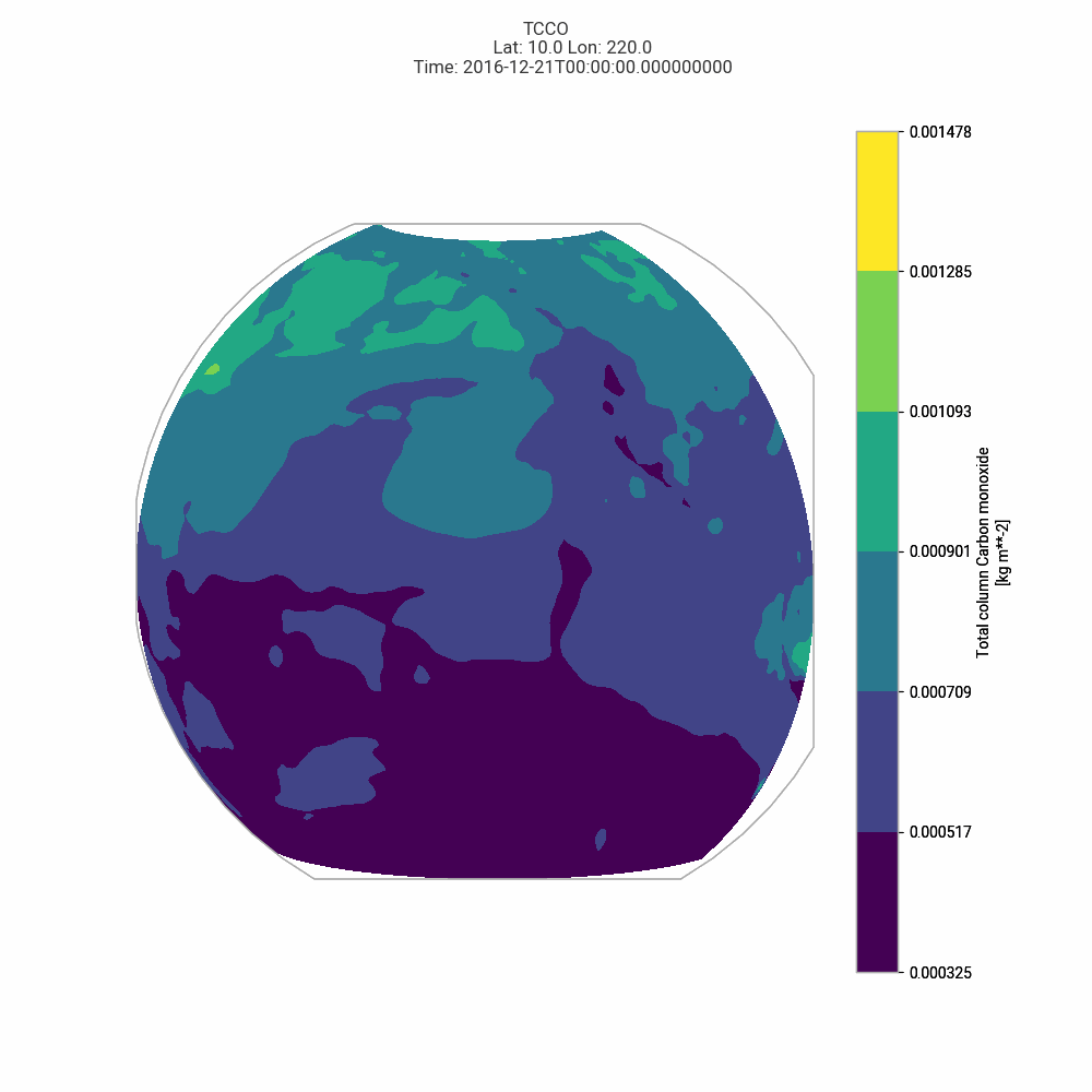
Contour animation
We can use the built-in plotting of Xarray with matplotlit's FuncAnimation to animate the data.
Start by selecting a single variable and a slice of time to animate. We'll also start by plotting the filled contour data, to simplify the animation.
ds_tcco = ds_wt_xr["tcco"].isel(time=slice(0, 4))
ds_tcco.plot.contourf(col="time")
<xarray.plot.facetgrid.FacetGrid at 0x12d1bd220>

from matplotlib.animation import FuncAnimation
from functools import partial
fig = plt.figure()
def plot_contour(frame, fig, ds, variable):
ax = fig.add_subplot(1, 1, 1, projection=ccrs.Orthographic(-130, 10))
ds_var = ds[variable]
# ds_var = ds_tcco
ds_var.isel(time=frame).plot.contourf(
ax=ax,
vmin=ds_var.min().item(),
vmax=ds_var.max().item(),
transform=ccrs.PlateCarree(),
)
fig.suptitle(
f"{variable.upper()}\n\
Lat: {ds_var.latitude.values.mean().round()} Lon: {ds_var.longitude.values.mean().round()}\n\
Time: {ds_var.time.values[frame]}"
)
ax.set_title("")
return ax,
i = 4
animation_function = partial(plot_contour, fig=fig, ds=ds_wt_xr.isel(time=slice(0,i)), variable="tcco")
anim_tcco_contour = FuncAnimation(
fig = fig,
func = animation_function,
frames = i,
interval = 500,
blit = False,
)
plt.show()
anim_tcco_contour.save('../data/anim_tcco_contour.gif', writer='pillow')
<Figure size 700x600 with 0 Axes>